


The picture above is from the Cleetwood Cove trail. It is the only access to the lake shore unless you get permission to throw yourself off one of the cliffs. People take the trail to swim in the lake, although they usually stay in briefly and get out pretty quickly. The lake water is cold. In the cove it may reach into the 60's, but if you swim out a few feet the rock ledge below you drops a couple of hundred feet. The bluer the water the colder.
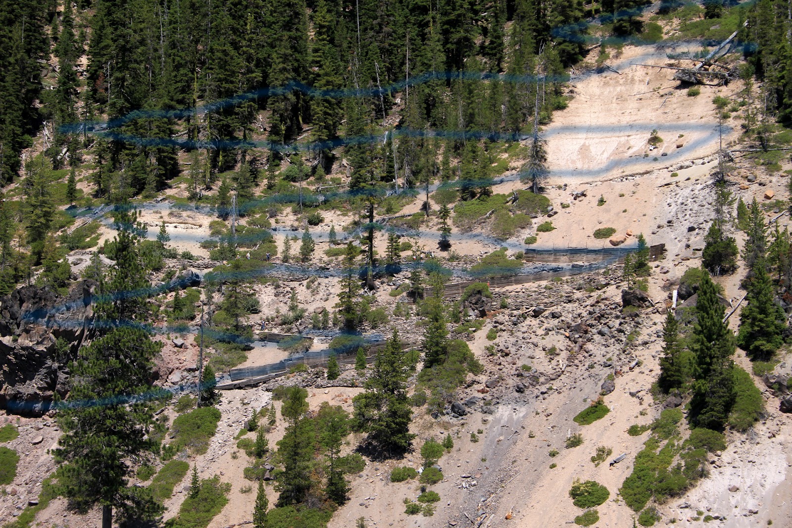
The trail is one mile long and during the descent you lose 700 feet in elevation. That means switch backs. I added the blue lines to make it easier to find the trail in the picture.
Hiking down took us about twenty minutes. Hiking up took us one hour and it is as strenuous as the booklet describes. Once we got down we boarded a small boat for a two hour tour. No three hour tours and the lake is contained inside the crater so a repeat of Gilligan's Island is not possible.
The small rocks that make up the substance around the trail are yellowish in color, indicating they've been exposed to sulfur. Scientists flew as DSRV (Deep Sea Rescue Vehicle) into Crater Lake by helicopter and explored. Towards the middle of the lake, 1400 feet below the surface, there are thermal vents indicating that the magma chamber below is still active and will likely erupt at some point. Before that happens there are hundreds, if not thousands of small earthquakes that serve as a warning, usually over a period of several weeks or months.
Over the geologic lifetime of the crater there were multiple volcanoes. Frequently the eruptions were violent and all the rock and lava thrown out and upwards eventually collapsed down. In some cases erosion removed most of the remnants of their existence. In others the rock's mineral content permitted much slower erosion and created unique formations. One of them is nicknamed the Phantom Ship. If you use your imagination when looking at the picture below you might see it.

This is what is left of a crater wall and it sits on a rock ledge which drops off more than one thousand feet. Right near this rock formation you can stand up. Move about 5 feet way from it and you are jumping off a thousand foot cliff.
There are fish in the lake, placed there by the National Park Service in the belief that no one would come to see it without another reason. Not that many people fish, so the ones that do catch very, very large trout. In order to fish you must use the Cleetwood Cover trail and then find a spot along the bank somewhere. No boats other than the ones the National Park Service operates, are permitted. Wading into the lake isn't advised.
The tree trunk you see below is called "the old man." It is over 100 years old and it floats slowly around the lake. It is always in a vertical position. Most logs float horizontally. This one is so stable that in the past people climb on top of it and pose for pictures. It isn't permitted any longer. It extends downwards about 60 feet.

While much of the snow eventually melts during the summer there are patches that never leave the park. Snow stops in May or June and resumes in October. In August, the melting snow creates waterfalls, like Aida Falls. This run off adds about 52 million gallons of water to the lake each summer. However, the lake has a maximum level it will not exceed. 250 feet below one of the cliffs, underwater, the rock is very porous. Water seeps through it into surrounding ground water. There are brief periods of time when the water level of the lake can get high, but it eventually returns to about the same height you see in all of the pictures.

No comments:
Post a Comment